
Bienvenue sur le site du Laboratoire de robotique boréale (norlab) de l'Université Laval. Notre laboratoire de recherche est spécialisé en systèmes mobiles et autonomes fonctionnant en conditions nordiques ou difficiles en général. Nous visons l'étude de problèmes reliés au algorithmes de navigation dans l'optique de repousser les limites de ce qui est présentement possible de faire avec un robot mobile en conditions d'utilisations réelles. Présentement, nos efforts sont dirigés vers les algorithmes de localisation basés sur les capteurs laser (lidar) et sur la reconstruction 3D d'environnements. Nous utiliserons ce site web afin de présenter nos résultats de recherche et de simplifier le transfert de connaissances grâce à des trucs et conseils généraux.
Nouvelles
:
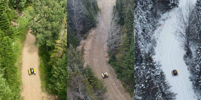
Le jeu de données FoMo est maintenant disponible !
FoMo est une collection multi-saisons enregistrée dans un environnement de forêt boréale, caractérisé par de la neige profonde, des terrains hors route, des ...
:
Norlab se rendra au Nunavut en mars 2026 pour évaluer les défis de l'Arctique. ↗
(Anglais seulement) Cette page redirige vers l’article original sur Eye on the Arctic.
Recherche
:
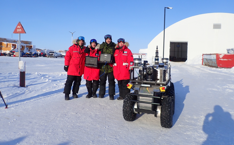
Les défis de l'Arctique pour les systèmes robotiques : retours d'expérience de la mission Nanook 2026
L’Arctique est l’un des environnements les plus exigeants pour les systèmes robotiques autonomes. Le froid extrême, les paysages dépourvus de repères, les te...
:
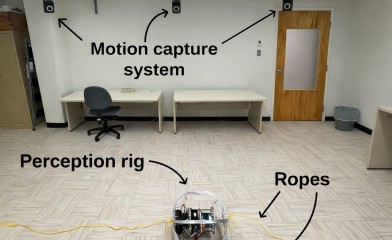
High-Resolution Motion Capture (HRMC) Dataset
(Seulement en anglais) The HRMC dataset provides high-frequency ground-truth motion data, capturing the full 6-degree-of-freedom (6-DoF) pose of the system over time. This includes...
:

CRYOTIC
Le projet Challenger les Robots en missions atYpiques extérieures Obtenues Toute l’année Incluant lors de Conditions extrêmes (CRYOTIC) vise à aborder les dé...
Publications
:
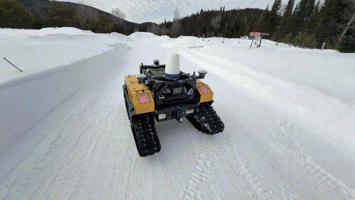
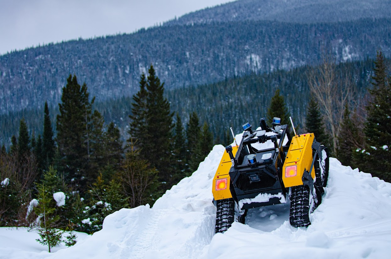
Toward Teach and Repeat Across Seasonal Deep Snow Accumulation
(Seulement en anglais) Download article Visit FoMo page We deployed again to Forêt Montmorency in March 2025. With over 1 m of snow accumulation, it was a perfect time to st...
:
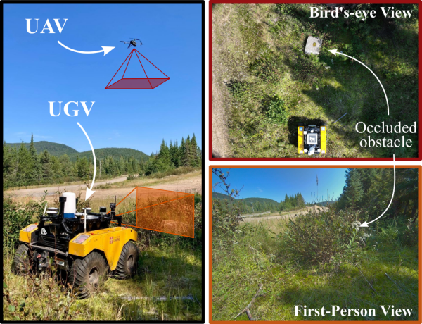
UAV-Assisted Self-Supervised Terrain Awareness for Off-Road Navigation
(Seulement en anglais) Paper Link
:
Exposing the Unseen: Exposure Time Emulation for Offline Benchmarking of Vision Algorithms
(Seulement en anglais) Download article Visit GitHub page
:
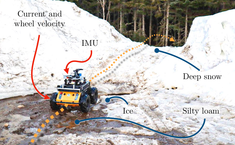
Proprioception Is All You Need: Terrain Classification for Boreal Forests
(Seulement en anglais) Webpage ArXiv preprint Slides Cite this