This large scale forest mapping dataset is now available for download on Valeria or on Academic Torrents. The dataset contains the ground truth species, diameter at breast height (DBH) and position of more than 1000 trees across four forests, as well as 11 trajectories of a lidar-equipped robot going through these forests. It has been the subject of a publication at the 12th Conference on Field and Service Robotics, as well as the Journal of Field Robotics.
Dataset structure
In the file paths, the textual site names (MATURE, etc.), are not used like in the research articles.
Rather, we use a shorter numerical ID: YOUNG is 1, MIXED is 2, MATURE is 3 and MAPLE is 4.
The dataset is split into three categories. The first, the ground truth data, is located in the folder groundTruthSite{SITE_ID}/. The robot sensor data and mapping results are in data{SITE_ID}_{DATE}.
Table 1: Contents of the raw data bags and the mapping bags.
| Topic name | Description | Rate (Hz) |
|---|---|---|
| Raw data bag | ||
| /mti/sensor/imu | IMU data | 100 |
| /axis/camera/image_compressed | RGB camera feed | 30 |
| /husky_velocity_controller/odom | Wheel odometry | 30 |
| /husky_velocity_controller/cmd_vel | Controls | Variable |
| /velodyne_packet | Lidar raw data | 10 |
| Mapping bags | ||
| /icp_odom | ICP trajectory | 10 |
| /odom/filtered | EKF trajectory | 100 |
| /point_map | Localization map | Variable |
Ground truth data
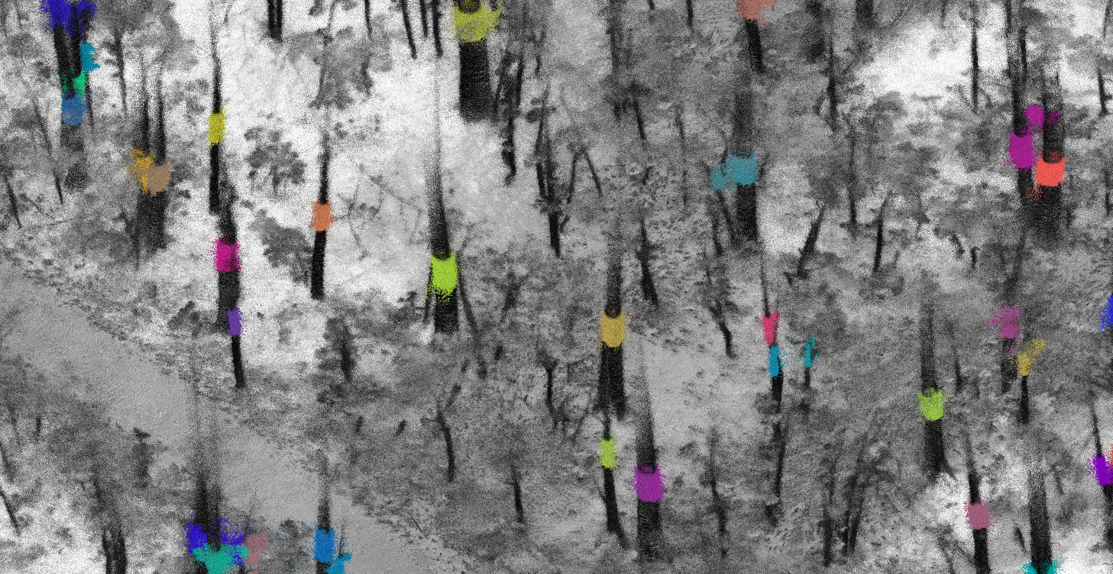
The ground truth data consists of the bounding boxes for individual trees as well as the DBH and picture of each trees. Under the directory Trees/, every tree that was manually segmented from the reference trajectory is present in the file {TREE_ID}.pcd.
Under the directory photos/, ground-truth data for each tree is present. The pictures themselves contain no information necessary for DBH estimation, but provide useful clues pertaining to the shape of the trees and the presence of branches at breast height. These two factors are important for measuring DBH. The file name of each tree picture gives the ground-truth DBH and species of this tree and has this format: {TREE_ID}_{SPECIES}_{DBH}.jpg, the DBH being in millimeters.
Robot sensor data
The robot raw sensor data (in the rosbag file format) consists of the recording of the robot’s sensor reading while it was performing the trajectories. There is one bag per trajectory. The contents of the bags are shown in Table 1. Sometimes the bag name is followed by _time, meaning that the beginning and end of the bag was truncated to remove periods where the robot did not move. Only the raw Velodyne data is present in the bags due to disk space constraints, meaning one has to run Velodyne’s ROS node (http://wiki.ros.org/velodyne) along with the bag to get standard point cloud messages.
Mapping results
For each trajectory, there is a directory that contains the results of our mapping algorithm, with various point densities. The final dense 3D maps, (in the pcd file format) are in the tmp/ sub-folder of each mapping directory. output.pcd contains all of the lidar points which means it is very large and unsuitable for visualization. outputsmall.pcd is a smaller filtered point cloud where only the 40 millions points with the strongest return intensity were kept. tf_to_ref.txt contains the rotation matrix from the mapping results to the reference coordinate system of the bounding boxes, computed from the approach described in (Tremblay et al., 2020). outputrot.pcd and outputsmallrot.pcd contain both previously described point clouds, now in the reference coordinate system. The mapping results also include a bag file vizBag.bag which contains the ICP trajectory and other information detailed in Table 1. Furthermore, the ethz_icp_mapper and EKF settings are preserved in params/ in each mapping result directory.
If you have any questions or requests, contact Jean-François Tremblay at jft@cim.mcgill.ca.
References
- Tremblay, J.-F., Béland, M., Pomerleau, F., Gagnon, R., & Giguère, P. (2020). Automatic 3D Mapping for Tree Diameter Measurements in Inventory Operations. Journal of Field Robotics. https://doi.org/10.1002/rob.21980 Special issue: Field and Service Robotics
Publisher Bibtex source - Tremblay, J.-F., Béland, M., Pomerleau, F., Gagnon, R., & Giguère, P. (2019). Automatic 3D Mapping for Tree Diameter Measurements in Inventory Operations. Proceedings of the Conference on Field and Service Robotics (FSR). Springer Tracts in Advanced Robotics.
PDF Slides Bibtex source