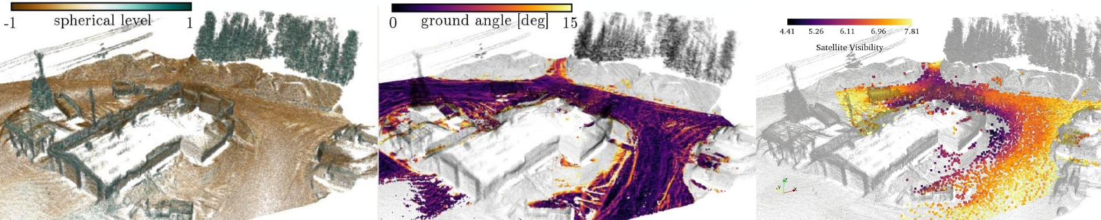
To help future mobile agents plan their movement in harsh environments,a predictive model has been designed to determine what areas would be favorable for Global Navigation Satellite System (GNSS) positioning. The model is able to predict the number of viable satellites for a GNSS receiver, based on a 3D point cloud map and a satellite constellation. Both occlusion and absorption effects of the environment are considered. A rugged mobile platform was designed to collect data in order to generate the point cloud maps. It was deployed during the Canadian winter known for large amounts of snow and extremely low temperatures. The test environments include a highly dense boreal forest and a university campus with high buildings. The experiment results indicate that the model performs well in both structured and unstructured environments.
Quick facts:
- This method has been tested in diverse environments such has a highly dense boreal forest and a university campus with high buildings
- This method is able to differentiate between forest and buildings
- The hardware used in the paper has been proven to work in sub-arctic environment
- Our preprint is available here
Video
Publications
- Dandurand, P., Babin, P., Kubelka, V., Giguère, P., & Pomerleau, F. (2019). Predicting GNSS satellite visibility from dense point clouds. Proceedings of the Conference on Field and Service Robotics (FSR). Springer Tracts in Advanced Robotics.
PDF Bibtex source