Forestry is a major industry in many parts of the world. It relies on forest inventory, which consists of measuring tree attributes. We propose to use 3D mapping, based on the iterative closest point algorithm, to automatically measure tree diameters in forests from mobile robot observations. While previous studies showed the potential for such technology, they lacked a rigorous analysis of diameter estimation methods in challenging forest environments. Here, we validated multiple diameter estimation methods, including two novel ones, in a new varied dataset of four different forest sites, 11 trajectories, totalling 1458 tree observations and 1.4 hectares. We provide recommendations for the deployment of mobile robots in a forestry context. We conclude that our mapping method is usable in the context of automated forest inventory, with our best method yielding a root mean square error of 3.45 cm for our whole dataset, and 2.04 cm in ideal conditions consisting of mature forest with well spaced trees.
Quick facts:
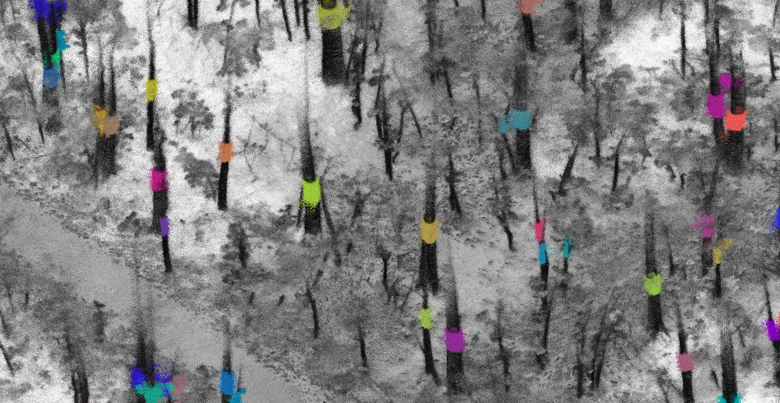
- 1.4 hectares of forest mapped with a Clearpath Husky and a Velodyne HDL-32E
- 943 trees were manually segmented in point clouds, and their diameter and species was identified on the field.
- Biggest dataset for 3D forest mapping and tree diameter measurements
- We tested various diameter estimation methods
- Part of the Automated Forestry and Logging Operations project
- Our preprint is available here
Video
Publications
- Tremblay, J.-F., Béland, M., Pomerleau, F., Gagnon, R., & Giguère, P. (2020). Automatic 3D Mapping for Tree Diameter Measurements in Inventory Operations. Journal of Field Robotics. https://doi.org/10.1002/rob.21980 Special issue: Field and Service Robotics
Publisher Bibtex source - Tremblay, J.-F., Béland, M., Pomerleau, F., Gagnon, R., & Giguère, P. (2019). Automatic 3D Mapping for Tree Diameter Measurements in Inventory Operations. Proceedings of the Conference on Field and Service Robotics (FSR). Springer Tracts in Advanced Robotics.
PDF Slides Bibtex source